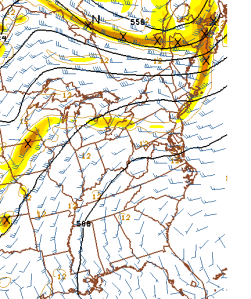
Data shows less humid air moving into Central Jersey for Saturday. Highs still in the upper-80s, could see a 90F reading in New Brunswick, which is famous for breaking high forecasts
Overnight we’ll have a vorticity maximum to our northeast, helping to develop the line of thunderstorms currently in eastern Pennsylvania. Whether or not they’re torn apart by the time they reach Central Jersey is hard to say. Current HRRR simulated max radar does not indicate heavy precipitation for most of Central Jersey. Greatest likelihood over Raritan.
40% thunderstorms Union County/Northern Middlesex County/Northern Somerset County
60% thunderstorms Central+South Middlesex County/South Somerset/Mercer Counties
30% thunderstorms northern Monmouth County
0% Central and South Monmouth County
NOTE: If line holds up as it approaches New Jersey, Somerset and Mercer could see more prolonged rain than areas east.
Overnight winds shift north as the cold front dips into the region around 4 am. Partly cloudy with clouds building to their peak around 8am to 9am, so heating tomorrow will be delayed.

The area may struggle to get rid of overcast skies. The southern half of New Jersey will have more cloudy skies than the northern half, so an inverted temperature gradient may develop depending on how thick the clouds are and where they line up.
Tomorrow’s forecasted high for New Brunswick: 89
Low for tonight: 75 – I’m saying that clouds are going to move in to prevent temperatures from getting too low, though the cold front is kept in mind. If it rains, expect the low to reach the dewpoint – 72. Percentages:
80% for 75
19% for 72
1% for 74
Low for tomorrow night: 67 because the clouds should disappear for tomorrow night with the lower dewpoints and overall less moist air.
